A trained inspector standing on scaffolding 50 metres above the stilling basin floor, marking cracks on a paper sketch of the dam face. That image has defined concrete dam inspection for decades. It is slow, subjective, weather-dependent, and places people in genuinely dangerous positions.
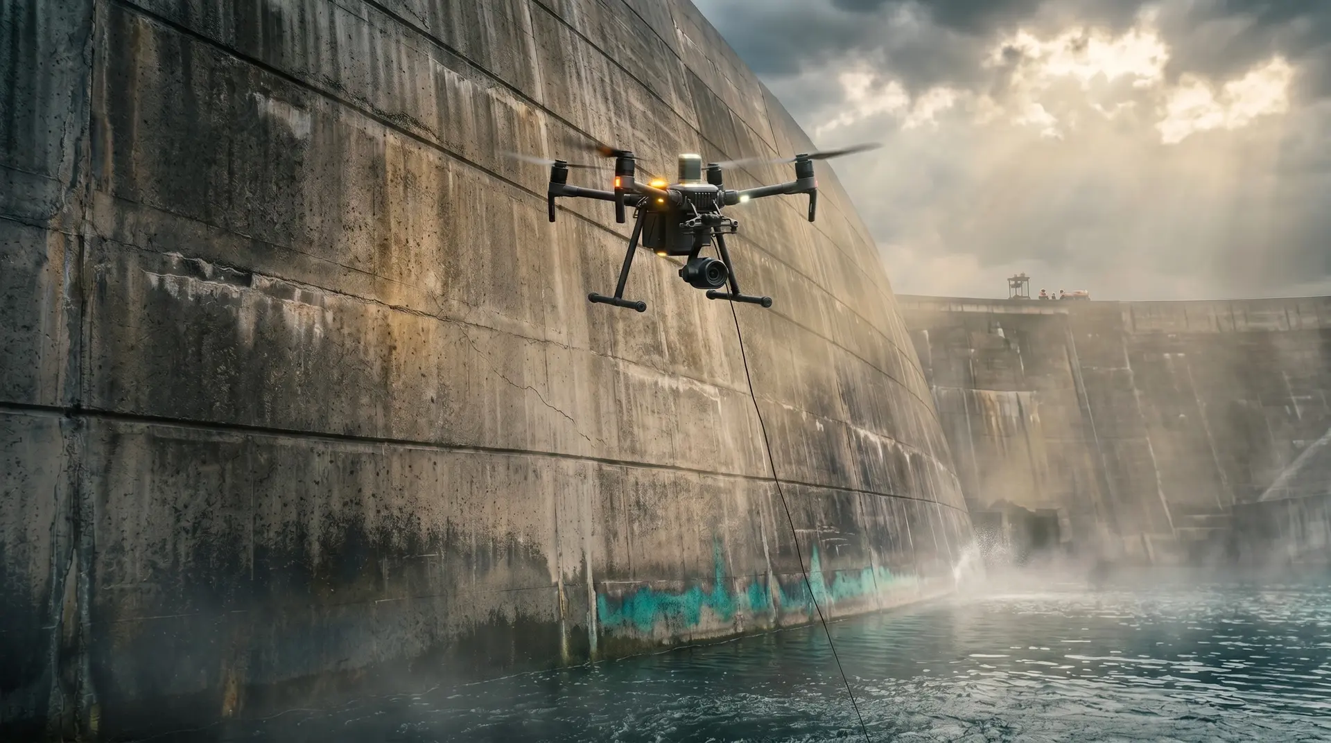
The replacement is already operating on hydroelectric dams in Sweden, the United States, and China. At the Storfinnforsen Hydroelectric Power Station (112 MW, commissioned 1954) in northern Sweden, the asset owner Uniper deployed ScoutDI’s autonomous Scout 137 drone system for a large-scale concrete inspection. The system captured over 300,000 location-tagged, high-resolution images in 52 flight hours, covering the two largest dam compartments 50% faster than fully manual operation. Extrapolated across all 80 remaining compartments, the estimated savings exceeded 40 workdays. No scaffolding was erected. No personnel worked at height.
This article examines the current state of automated inspection technology for concrete dams: what works, what each system can and cannot detect, the AI models processing the data, and how dam owners can integrate these tools into their inspection programmes.
The Inspection Technology Stack
Modern dam inspection technology operates at four levels, each addressing a different portion of the structure.
Aerial Drones (UAVs): Above-Water Surfaces
Unmanned aerial vehicles are the most mature and widely deployed platform. For concrete dams, the workflow follows three stages.
Stage 1: Data acquisition. The drone flies a pre-programmed or semi-autonomous path along the dam face, capturing overlapping high-resolution photographs at consistent distances. Advanced systems like ScoutDI’s Scout 137 use tethered power supplies for unlimited flight time and feature autonomy capabilities including Auto Surface Scan, Auto Image Capture, and Distance Lock. The tethered approach eliminates battery swap logistics, which matters on large dams where inspection coverage can require dozens of flight hours.
Stage 2: AI-powered defect detection. Deep learning models process the image dataset to identify and classify surface defects. The current generation of models achieves the following performance levels:
| Model Architecture | Application | Performance |
|---|---|---|
| YOLOv8 + U-Net | Dam surface defect detection | Recognition accuracy 0.84, recall 0.98, segmentation accuracy 0.91 |
| CS-YOLO (lightweight) | Concrete crack segmentation | 90.4% mAP |
| EfficientNetB0 | Borehole crack classification | 91% accuracy |
| Custom CNN (Seattle City Light) | Real-time crack/spalling detection | 80 million coordinates processed |
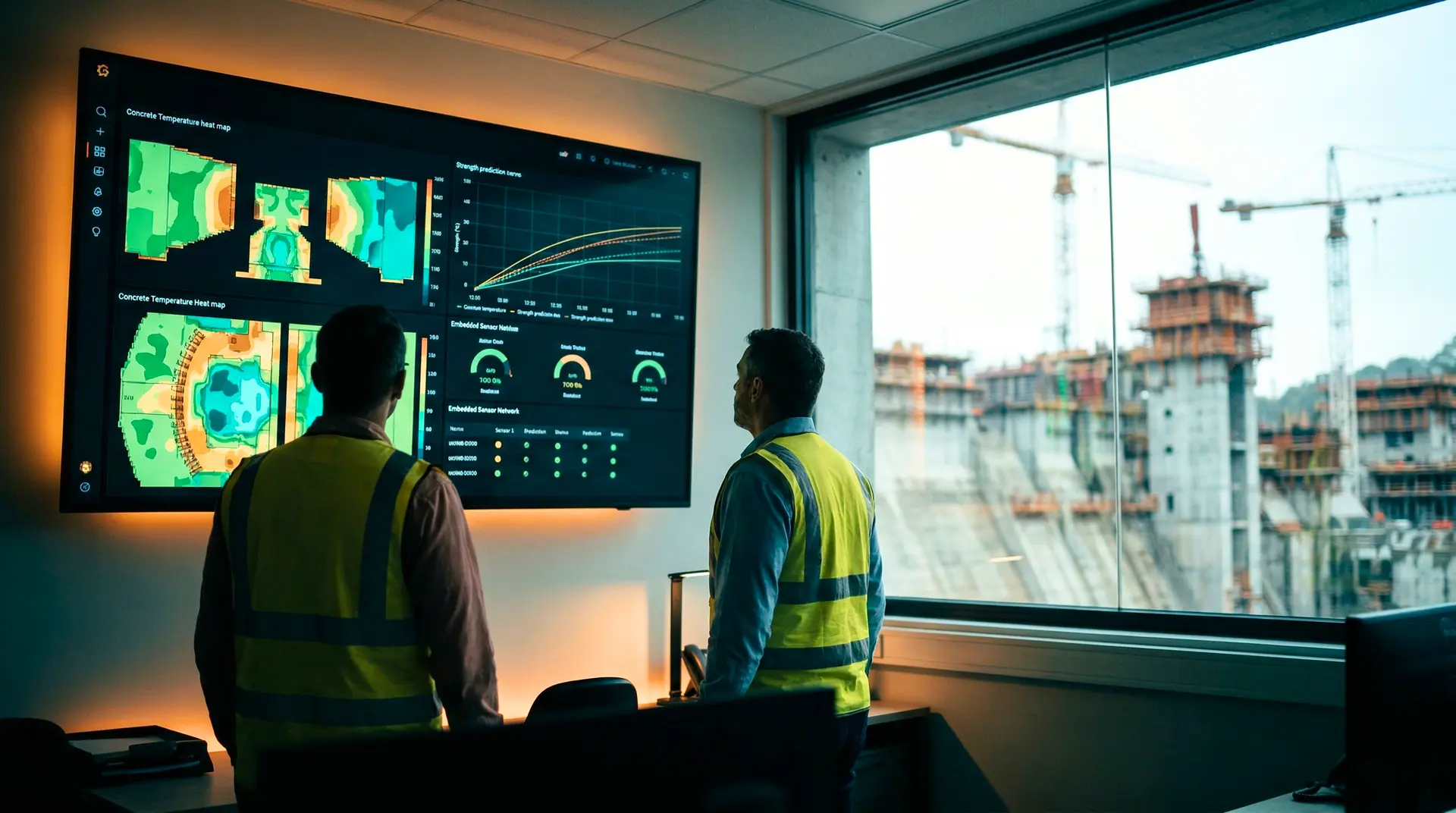
Each crack is assigned a unique identifier along with its dimensions, orientation, and precise location on the structure. This transforms inspection from a subjective assessment into a quantitative measurement.
Stage 3: 3D reconstruction and tracking. Photogrammetry software processes the overlapping images into georeferenced 3D point clouds and textured models. When the same drone flies the same path months or years later, crack progression becomes measurable in millimetres through point cloud comparison, not dependent on whether the same inspector returns.
What AI crack detection cannot do
Surface-based computer vision detects only what is visible on the concrete face. It cannot determine crack depth, assess embedded reinforcement condition, identify internal voids, or detect delamination. For subsurface assessment, drone data must be paired with non-destructive testing methods such as ultrasonic pulse velocity, impact echo, or ground-penetrating radar.
LiDAR and Terrestrial Laser Scanning: Deformation Monitoring
Terrestrial laser scanning (TLS), also known as ground-based LiDAR, provides sub-millimetre deformation measurement capabilities. By generating dense 3D point clouds of the dam surface from fixed survey positions, TLS enables detection of structural movement that would be invisible to visual inspection.
The technology is particularly valuable for arch dams where deformation patterns indicate structural response to loading, and for gravity dams where tilting or settlement may signal foundation issues. Repeat scans at intervals (annually, or more frequently during significant loading events) build a deformation history that feeds into structural health monitoring programmes.
When combined with drone photogrammetry, the result is a comprehensive digital record: LiDAR provides geometric precision for deformation tracking, while drone imagery provides surface condition detail for defect identification. The combined dataset forms the foundation for what the industry is beginning to call a “digital twin” of the dam.
ROVs: Submerged Surfaces
The portions of a concrete dam that are permanently or seasonally submerged require a different platform. Remotely operated vehicles (ROVs) carry high-definition cameras and sonar systems to survey concrete degradation, scour, joint separations, and surface erosion below the waterline.
Recent research has developed CNN-integrated frameworks specifically for underwater dam micro-crack inspection using ROV-collected imagery. A customizable end-to-end framework was validated on a large-scale concrete dam in China, with key frames extracted from ROV video footage forming a training dataset for underwater crack detection models.
The challenges are substantial. Underwater visibility varies dramatically with sediment load, algae growth, and ambient lighting. Image quality from ROV cameras is inherently lower than aerial drone photography, making AI-based defect detection more difficult. Despite these limitations, ROV inspection eliminates the safety risks of dive-based assessment in cold, deep, or high-current environments near dam intakes and outlets, environments where concrete deterioration is often most severe.
Robotic Platforms: Confined Spaces
The U.S. Army Corps of Engineers’ DamBot represents an emerging category: robotic platforms designed for dam galleries, conduits, and outlet works. Developed by the Engineer Research and Development Center (ERDC), the DamBot is a tele-operated robot carrying high-resolution cameras, LiDAR sensors, and an extendable arm for photographing hard-to-reach areas.
The DamBot Mini was successfully tested at Alamo Dam and deployed for a conduit inspection at Taylorsville Lake Dam, Kentucky in September 2024. The platform won the 2021 USACE Innovation of the Year Award. Its primary purpose is safety: dam conduits and outlet works are confined spaces where hydrogen sulphide gas buildup poses a direct threat to inspection personnel. The robot provides a first look at conditions before any person enters the space.
For dam operators in South Asia, the concept is directly relevant. Many aging dams have galleries, drainage galleries, and outlet works that are difficult and potentially hazardous to inspect manually. While the DamBot itself is a USACE-specific platform, commercial robotic inspection systems for confined infrastructure are becoming available.
The AI Pipeline: From Pixels to Engineering Decisions
The raw data from any inspection platform (drone images, LiDAR scans, ROV footage) has limited value until it is processed into engineering-actionable information. The AI pipeline transforms hundreds of thousands of images into a structured defect inventory.
Object Detection: Finding the Defects
The first processing stage uses object detection models, primarily from the YOLO (You Only Look Once) family, to locate defects within each image. YOLO architectures are favoured for their real-time processing speed and strong performance on concrete crack detection tasks. The latest variants (YOLOv8 and its derivatives) balance detection accuracy with computational efficiency, enabling processing on edge devices rather than requiring cloud infrastructure.
The challenge specific to dam concrete is distinguishing genuine defects from visual noise. Seattle City Light’s programme at Diablo Dam (389 feet, 208 MW) illustrates this precisely: their team is developing AI algorithms specifically to differentiate concrete cracks and spalling from algae growth, moss, shadows, and discolouration. This is a harder classification problem than general concrete crack detection because dam surfaces accumulate biological growth over decades of exposure.
Semantic Segmentation: Measuring the Defects
Detection alone tells you where a crack is. Segmentation tells you its width, length, branching pattern, and area. U-Net and its variants are the dominant architectures for this task, producing pixel-level masks that outline defect boundaries precisely. When calibrated against known reference dimensions in the image (or using photogrammetric distance measurements), segmentation output provides dimensional data for every detected defect.
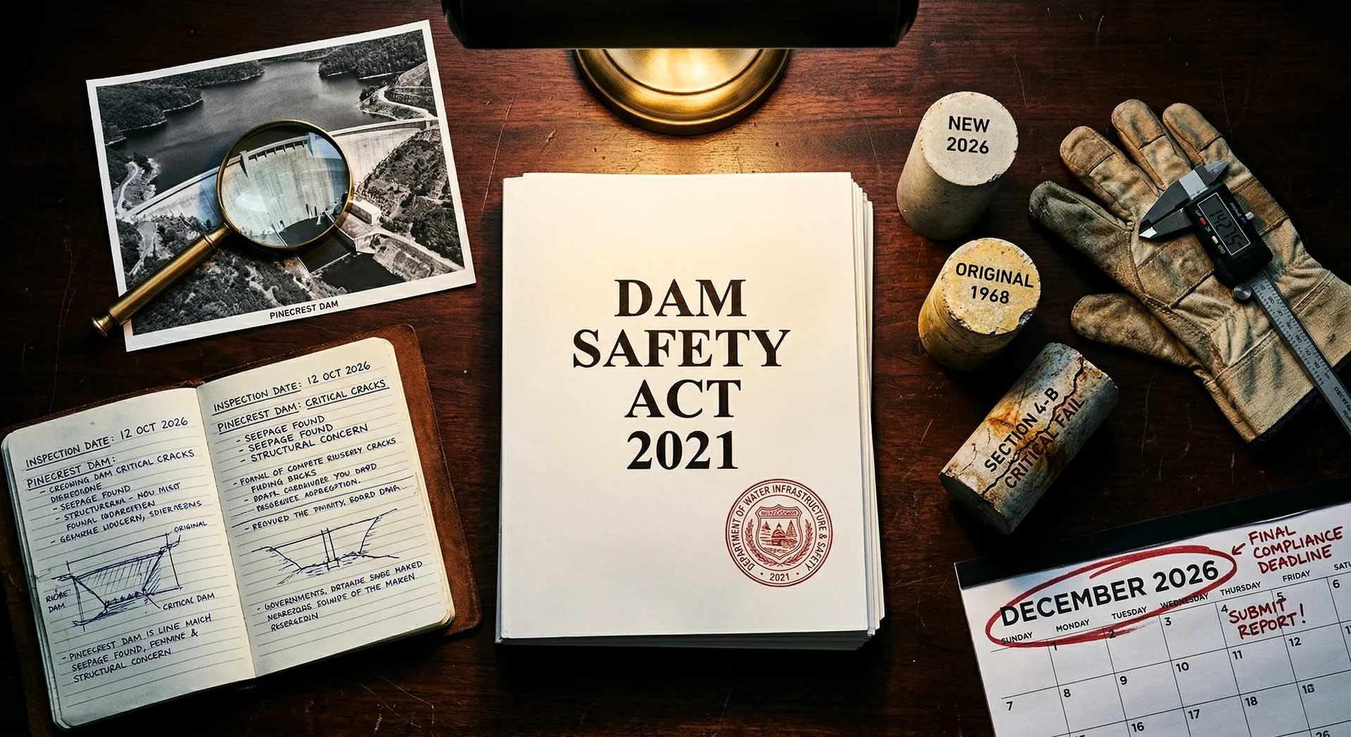
This capability directly supports the quantitative condition assessment that dam safety regulations increasingly demand. Under India’s Dam Safety Act 2021, the emphasis on data-driven safety assessment creates a natural fit for AI-generated, dimensionally accurate defect inventories.
Change Detection: Tracking Progression
The highest-value application may be temporal: comparing inspection datasets from different dates to measure defect progression. A crack that was 0.3 mm wide in 2024 and is 0.5 mm wide in 2026 tells an engineer something fundamentally different from a crack that has remained stable at 0.3 mm for five years.
Achieving reliable change detection requires consistent data acquisition: the same flight paths, similar lighting conditions, and robust image registration algorithms. When these conditions are met, the combination of photogrammetry and AI creates a monitoring capability that was previously available only through permanently installed instrumentation (crack gauges, extensometers) at discrete points on the structure.
Practical Deployment Framework
For dam owners and consulting engineers evaluating drone-based inspection, the following framework addresses the most common deployment questions.
When to Use Each Technology
| Structure Element | Primary Platform | Complementary Method |
|---|---|---|
| Downstream face (above tailwater) | Aerial drone | LiDAR for deformation |
| Upstream face (above reservoir) | Aerial drone | LiDAR for deformation |
| Submerged upstream face | ROV | Sonar for profile mapping |
| Spillway chute and stilling basin | Aerial drone (dry conditions) | ROV (submerged elements) |
| Galleries and drainage tunnels | Robotic platform or handheld | Fixed instrumentation |
| Outlet works and conduits | Robotic platform | ROV for submerged portions |
| Crest and access areas | Aerial drone or walking survey | Standard visual inspection |
Integration with Conventional Inspection
Drone-based inspection does not replace engineering judgment. It provides better data for that judgment to act on. The recommended integration model is:
- Baseline survey: Commission a comprehensive drone inspection to establish a quantitative record of all visible surface conditions. This becomes the reference dataset.
- Routine monitoring: Conduct follow-up drone inspections at intervals appropriate to the structure’s condition and risk classification (annually for high-hazard dams per FERC and CWC guidelines, more frequently for active deterioration zones).
- Targeted NDT: Use the drone defect map to guide placement of non-destructive testing at locations flagged by AI as areas of concern. This makes NDT more efficient by focusing on high-priority areas rather than scanning entire surfaces.
- Engineering assessment: The consulting engineer reviews the AI-generated defect inventory alongside NDT results, thermal control performance, and loading history to make disposition decisions.
Challenges for South Asian Dam Projects
Deploying drone inspection on hydroelectric projects in India, Bhutan, and Nepal introduces specific challenges:
- Altitude and weather: Many dam sites in the Himalayas sit above 1,500 metres. Reduced air density affects drone lift capacity and battery performance. Monsoon weather restricts flying windows to approximately six months per year.
- Regulatory environment: India’s DGCA drone regulations (Digital Sky platform) require specific approvals for operating near critical infrastructure. Dam sites in border areas may have additional airspace restrictions.
- Connectivity: Cloud-based AI processing requires data upload, which is difficult at remote dam sites. Edge computing solutions that process imagery locally are available but add hardware cost.
- Workforce readiness: The technology requires trained drone pilots with dam-specific experience, and engineers who can interpret AI-generated defect data in the context of structural behaviour.
Despite these challenges, the fundamental value proposition holds. Indian dam owners managing portfolios of aging concrete structures, particularly under the Dam Rehabilitation and Improvement Project (DRIP), need efficient, repeatable condition assessment at scale. Drone-based inspection delivers exactly that capability.
What Comes Next
The trajectory is clear. Inspection platforms are becoming more autonomous (ScoutDI’s Auto Surface Scan is a current example). AI models are becoming more accurate and more specialised for dam-specific defect types. Processing is moving from the cloud to edge devices deployable at remote sites. And the cost per inspection is declining as the technology matures and competition increases.
For consulting engineers, the shift creates a new competency requirement. Understanding what the AI output means in structural terms, knowing when a flagged anomaly warrants investigation versus when it is cosmetic, and integrating automated inspection data into a comprehensive QA/QC framework are skills that separate an effective dam inspection programme from a data collection exercise.
PCCI’s approach is to evaluate these technologies against the standards that matter: ACI, ICOLD, IS 457, and the Dam Safety Act 2021. The tools are ready. The question is whether dam owners and their consultants are ready to use them well.
For guidance on integrating automated inspection technology into your dam safety programme, contact PCCI’s consulting team.